Washington, Alexandria and Mount Vernon Electric Railway

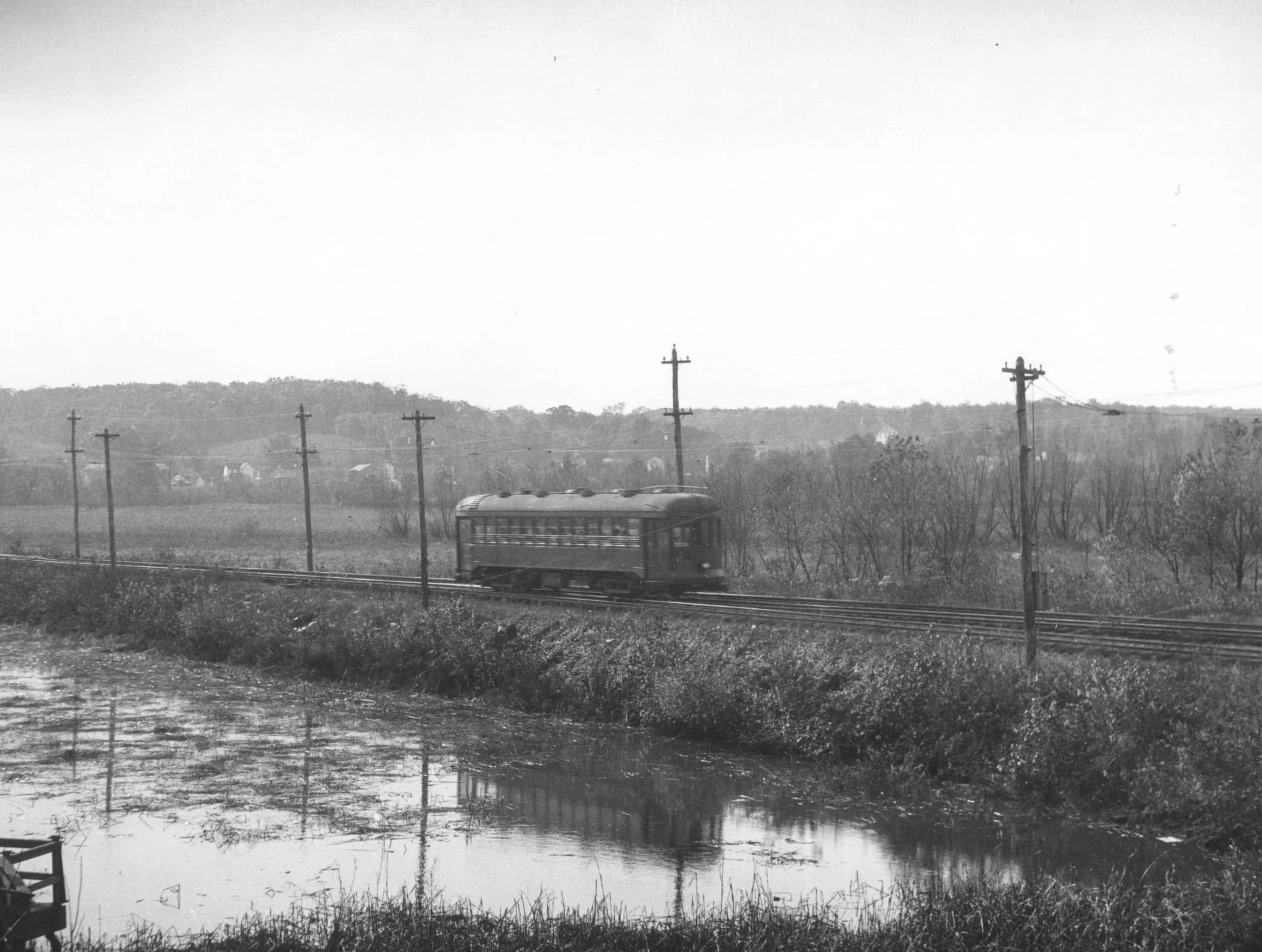
Electric Railroad passing over Four Mile Run in the 1920s from the Town Of Potomac Historical Association.

Originally published in the September 2024 edition of Greet Del Ray.

el Ray was established based on the availability of transportation, and one of those transportation lines was the Washington, Alexandria and Mount Vernon Electric Railway, which provided trolley services between Washington, D.C. and Mount Vernon. Chartered in 1890, this trolley system replaced the ferries that took tourists to Mount Vernon. When the system began planning expansion north of Alexandria in 1892, Charles E. Wood purchased land along the planned route to create Del Ray (see the April 2023 issue of Greet Del Ray). By 1896, the trolley system extended to Washing and Rosslyn, making it the longest streetcar line in the world.

In Del Ray, the trolley ran along what is today Commonwealth Avenue. It had two stops in Rosemont before entering what is today considered Del Ray. The Del Ray stops included near Alexandria Ave., Monroe Ave., Bellefonte Ave., Del Ray Ave., Mt. Ida Ave. (near the Duncan Library, where you can find a historical marker), Hume Ave., and near Ashby St. (which served as a transfer to the W&OD Railroad - see the June 2024 issue).

Initially, the presence of the trolley made Del Ray a convenient place to live for commuters to Alexandria and Washington. However, as more roads were paved (see the November 2023 issue) competition from bus lines and poor investment decisions led to the demise of the Electric Railway. The company went into receivership in 1923 and ceased operations in 1927. The right of way south of Alexandria was purchased by the Federal Government and turned into the George Washington Memorial Parkway. For a brief time, the trolleys operated north of Alexandria under new ownership, but all operations ceased in 1932. Unable to afford the cost of removing the tracks, the owners turned over the right of way to the City in lieu of removing the old tracks. The City then turned the right of way into Commonwealth Ave., while Arlington County turned it into S. Eads St. (You can read more about it on the Town of Potomac Historical Association website: https://potomacva.org/electric-railway.html)
Annexation of Jefferson District

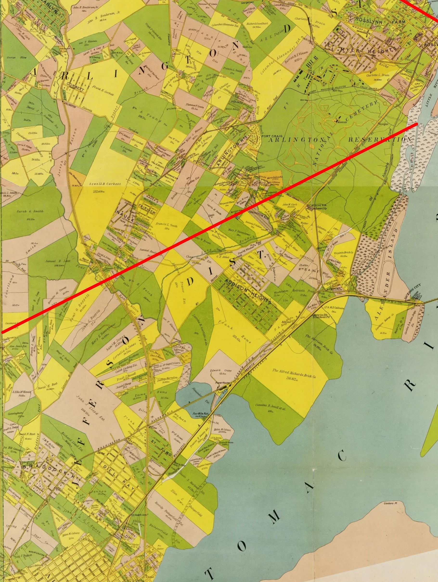
Jefferson District in 1900 from the Virginia Title Company’s Map of Alexandria County.

Originally published in the August 2024 edition of Greet Del Ray.

In 1847, the portion of the District of Columbia on the west side of the Potomac River retroceded to Virginia creating Alexandria County (subsequently renamed Arlington County in 1920). The new Virginia constitution of 1870 divided counties into three “townships” which later became magisterial districts. Alexandria County was divided into Washington District in the north, Arlington District in the center and Jefferson District in the south. The same constitutional change made Alexandria City, which only extended up to First Street, separate from the County.

The northern border of Jefferson District ran from approximately the northeast corner of Arlington Cemetery to the intersection of Quaker Lane and King Street. At the time of its creation, Jefferson District was very rural, consisting of large farms, plantations and estates (see the August 2023 and December 2023 issues of Greet Del Ray). However, in the 1890s with the growth of transportation (see the June 2024 issue), small suburbs began to crop up between Alexandria and Washington. These included Braddock Heights (see the October 2023 issue), Addison Heights, Del Ray & St. Elmo (see the February 2023 issue). Similar growth occurred in the other districts with the villages of Rosslyn, Clarendon, Ballston, Bon Air, Glencarlyn, etc.

By the late 1920s, Alexandria sought to further expand its territories. On the premise of providing better services to its suburbs, like the Town of Potomac, Alexandria sought to annex the southern half of Jefferson District. In a contentious court case, Alexandria succeeded and the annexation took effect on 1 January 1930. The northern border of the city moved from First Street all the way up to Four Mile Run, almost doubling the size of the City. In response to this loss, the County passed several new ordinances preventing further annexations and reorganized into a County Manager form of government in 1932, which abolished the magisterial districts. Subsequently, Arlington County was treated as a consolidated entity more like a city than a county, and Alexandria looked west into Fairfax County for its next annexation in 1952.

W&OD Railroad

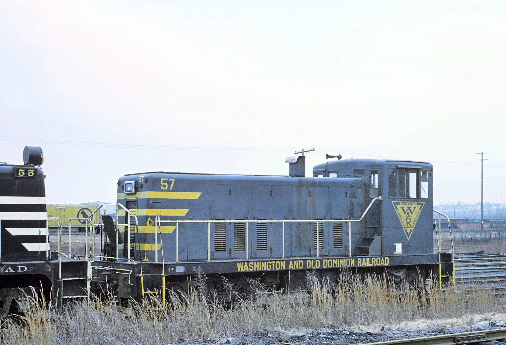
Washington & Old Dominion Railroad GE 95 Tonner #57, B&O Riverside Yard, Baltimore, MD, January 19, 1969, by Roger Puta via Wikipedia Commons.

Originally published in the June 2024 edition of Greet Del Ray.

Del Ray was established based on the availability of transportation, and one of those transportation lines was the Washington & Old Dominion (W&OD) Railroad. The railroad was originally constructed in 1855 passing through the Oakville Plantation (see the August 2023 issue) on its way from Alexandria to Leesburg. When Wood, Harmon & Company first laid out Del Ray in 1894 (see the April 2023 issue), the communities of Del Ray and St. Elmo straddled the W&OD rail lines. The rail line offered passenger service between Del Ray and Washington (via Old Town) or Vienna, Herdnon, Leesburg and beyond from the Alexandria Junction Station at Hume Ave. The railroad also offered cargo service which included several spurs into the new industrial park at Oakville Triangle.

In its heyday around 1911, the railroad’s passenger service was similar to today’s Virginia Railway Express (VRE), but it made the majority of its money hauling cargo from the Shenandoah to the Alexandria waterfront. The contract with the Postal Service to haul mail was all that kept the passenger lines profitable. When the Postal Service switched to trucks in 1951, passenger service on the W&OD came to an end. The railroad had struggled with profitability from the start and eventually went bankrupt in 1968. The last train rolled through Del Ray on 27 August 1968.

The railroad’s line through Arlington, Falls Church, Fairfax and Loudon became the W&OD Trail. However, in Alexandria, it was broken up. The major part of it through Del Ray became the Mt. Jefferson Park. The recent refurbishment of the park revealed several of the old rail lines that can be seen in the ground near the Stewart Ave. entrance. The park includes several historical markers about the railroad, including the “Bluemont Line” marker near the site of the Alexandria Junction Station. The Alexandria portion west of this park was developed into the Vernon Square office park and the Mount Vernon Court residential development. The railbed is still visible behind the Food Star, and the footer for the bridge over Russell Ave. is still visible across the street from the Grace Espiscopal School parking lot. These remnants serve as reminders of Del Ray’s railroad history … if you know what you are looking for.

The Mamas, The Papas and The Doors

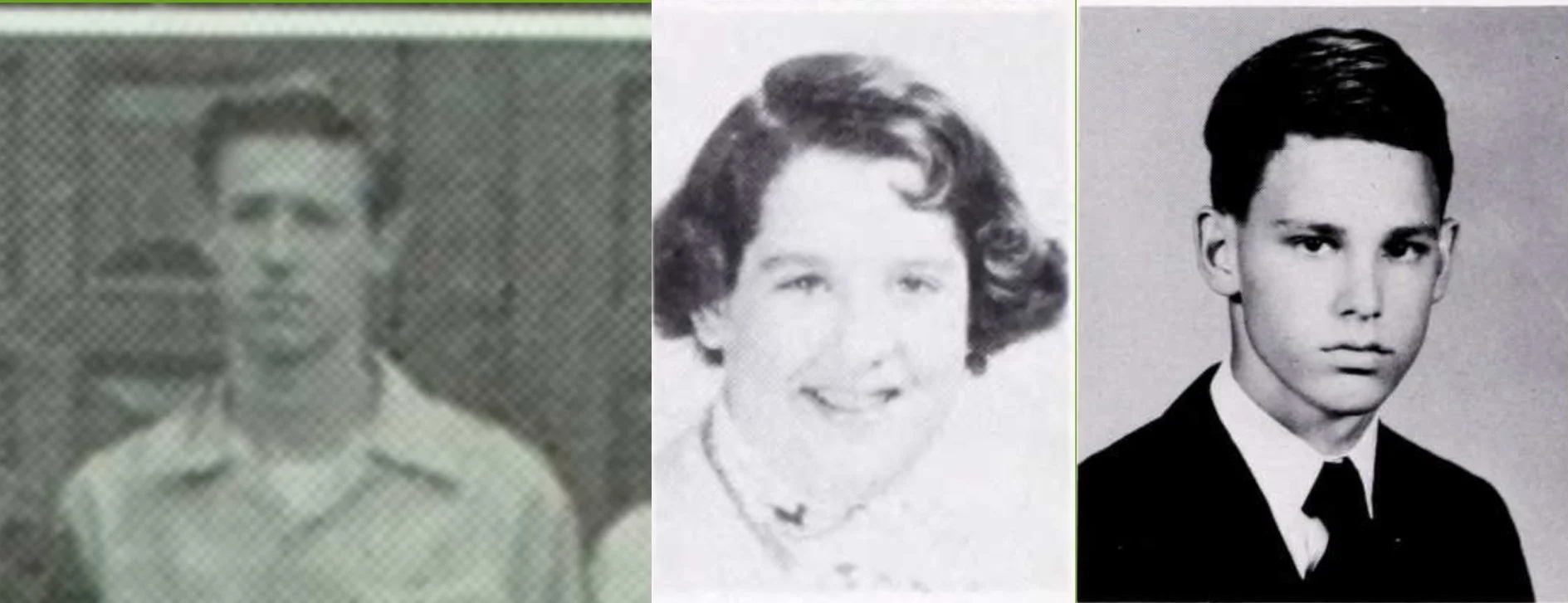
John Phillips in 1953, Cass Elliot in 1955 and Jim Morrison in 1961. This blog makes fair use of copyrighted materials for educational purposes. Resale and further distribution for commercial purposes is not authorized by the author without obtaining appropriate copyright release.


Originally published in the April 2024 edition of Greet Del Ray.

Alexandria has been home to a variety of famous people due to its proximity to Washington, D.C. In the case of Del Ray, a few famous musicians grew up in our area, which has become a bit of local lore.

The most famous is arguably Jim Morrison of The Doors. Morrison was the son of a Navy admiral who lived just outside of Del Ray on Woodland Terrace in the Jefferson Park neighborhood. Morrison spent his high school years from 1959-1961 going to George Washington High School (now the middle school). The mural on the side of St. Elmo's Coffee Pub pays tribute to him.

One of Morrison's classmates at G.W. High School was Cass Elliott of The Mamas & The Papas. Her family lived at Lacy Court on Commonwealth Ave until she was 15. Her father moved to Baltimore at that point, and she graduated from high school there. Prior to their move, she began attending G.W. High School in the same class with Jim Morrison.

Elliott's bandmate John Phillips was also a former Del Ray resident. Phillips grew up on E. Oxford Avenue and also attended G.W. High School, graduating in 1953. He formed his first successful band, The Journeymen, with his friend Scott McKenzie. McKenzie also attended high school in Del Ray, graduating from St. Stephens in 1957.

Other famous musicians who called Del Ray home include Mary Chapin Carpenter, who spent part of her life on E. Bellefonte Ave, and the Celtic band Scythian, which was formed in the basement of a house on Russell Road.

Suburban Alexandria

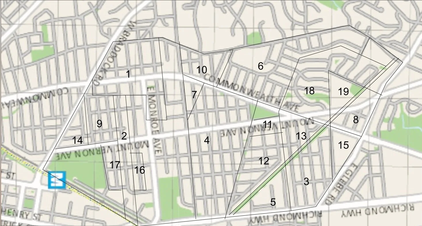
1 = Northwest Alexandria (1890); 2 = Park Addition (1892); 3 = St. Elmo (1894); 4 = Del Ray (1894); 5 = Oakville Triangle (1904); 6 = Mt. Ida (1908); 7 = Del Ray Section 2 (1911); 8 = St. Elmo Section 2 (1920); 9 = Brenton (1920); 10 = Rosecrest (1920); 11 = Mt. Vernon (1921); 12 = Abingdon (1922); 13 = Emma P Hume (1925); 14 = Temple Park Section 2 (1935); 15 = Auburn Village (1939); 16 = Linden Gardens (1939); 17 = Brenton Section 2 (1940); 18 = Warwick Village (1955); 19 = Calvert (1964)

Originally published in the February 2024 edition of Greet Del Ray.

Del Ray is currently recognized as the area bounded by Braddock Road, Russell Road, Glebe Road and Richmond Highway. However, this area consists of various historical real estate developments.

In the 1890s, increases in public transportation spawned a new phenomena: the suburb. Locally, the electric railroad between Washington, D.C. and Alexandria (now Commonwealth Avenue) prompted numerous new suburbs along its path. The first was Northwest Alexandria, which straddled Braddock and Russell Roads (see the October issue of Greet Del Ray). Laid out in 1890, the first portion to be developed was in what is now considered Del Ray. Two years later, Park Addition was added to this development along Alexandria Avenue.

In 1894, Wood, Harmon and Company developed St. Elmo and Del Ray (see the April issue), adding additions to the original area in the 1910s. These communities formed the Town of Potomac in 1908. In the first decade of the 1900s, some of the large estates were broken up. The Swann family sold off their Oakville estate to begin a residential development at Oakville triangle (see the August issue). This was subsequently abandoned and turned into an industrial park. In 1908, the heirs of John Lloyd sold off the Mt. Ida estate to create a new residential development (see the June issue).

Initially, these developments got a slow start, and large areas of vacant land remained. With the advent of public water and sewer lines in the early 1920s, the pace of movement to the suburbs increased thanks to indoor plumbing. The old racetrack was turned into the Mt. Vernon and Abingdon developments (see the September issue). The Brenton and Rosecrest developments on the west and south side of modern Del Ray were created around 1920, Emma P. Hume sold off part of the Warwick estate for another development next to St. Elmo. Numerous smaller land owners south of Bellefonte Avenue sold off individual lots as well.

World War II brought more developments in the vacant spaces on the southern edge of modern Del Ray with the Linden Gardens and Section 2 of both Temple Park and Brenton. Auburn Village was also constructed on land sold by the heir of Thomas Swann. As the last of the millionaire mansions on the western ridge of Del Ray were abandoned (see the December issue), some of the final developments were constructed. The Warwick estate became Warwick Village in 1955, and the Mt. Auburn estate became the Aspen and Calvert Apartments in the 1960s.

Millionaires' Ridge

Originally published in the December 2023 edition of Greet Del Ray.

Over the generations, the lands of John Alexander, for whom Alexandria is named, were divided among his heirs, and Charles Alexander inherited the land between the City of Alexandria and Four Mile Run in 1764. His land was mainly flat farm land, but it included the ridge along its Western side.

Charles' son, Charles, Jr., built his home, known as Mt. Ida, on the highest point of the ridge around 1800. The house is still standing at 304 Charles Alexander Court. After Charles, Jr. died in 1812, his widow remarried and had two more children. The Mt. Ida estate passed to her daughter Elizabeth Lloyd in 1864. Elizabeth's husband John sold the Southern portion of their lands to his brother Richard Lloyd in 1865, who built the Belmont house that now serves as the administrative building for the St. Stephen and St. Agnes Lower School.

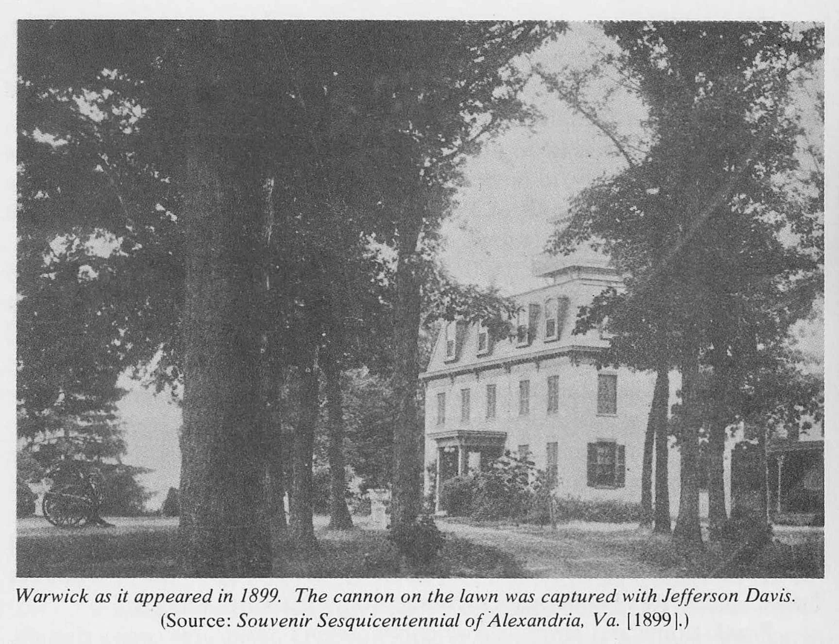
Another portion of Charles Sr.'s land went to his daughter Frances B. Swann. She and her husband William Swann lived at Oakville (see the August 2023 issue of Greet Del Ray), but their son Thomas built Mt. Auburn on the North end of the ridge in the late 1850s. Thomas Swann sold part of his lands to Frank Hume in 1879, who moved into Warwick, located just South of Mt. Auburn.

By the end of the Nineteenth Century, the ridge line was dominated by these four grand estates owned by millionaires. However, the cost of maintaining such homes and the demand for additional housing led to their break up. John Lloyd died in 1871, and his heirs began selling off the Mt. Ida lands to developers around 1908 (see the June 2023 issue of Greet Del Ray). After Frank Hume died in 1906, his widow moved into D.C., leaving Warwick to decay. It was torn down in the early 1950s to make way for Warwick Village. Thomas Swann's granddaughter lived in Mt. Auburn until her death in 1964, after which the house was torn down to make way for the Aspen Apartments.

Northwest Alexandria

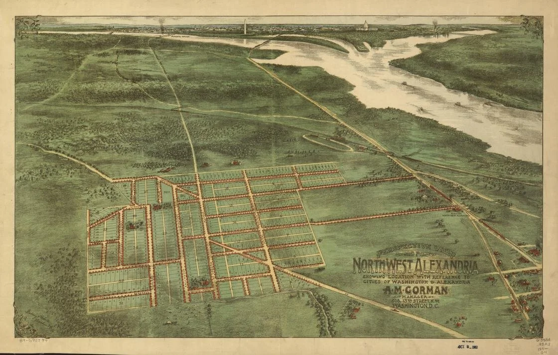
Developers map of the new community of Northwest Alexandria circa 1890. Gedney & Roberts, and A. M Gorman. Perspective view of northwest Alexandria: showing location with reference to cities of Washington & Alexandria. [Washington, D.C.: A.M. Gorman, 189, 1890] Map. https://www.loc.gov/item/89692599/.

Originally published in the October 2023 edition of Greet Del Ray.

One of the original suburbs of Alexandria was located where Del Ray, Rosemont and North Ridge meet today. Almost four years before Del Ray was founded, the Northwest Alexandria Improvement Company began selling lots in their new development, which became known as Braddock Heights. The company advertised the splendid views of Washington, Alexandria and the Potomac River. They also highlighted the planned road from Washington to Mount Vernon and new electric railway passed through the new suburb. Two years later in 1892, the electric railroad opened passing through the new settlement along the path of modern day Commonwealth Avenue. It had two stations within the subdivision to pick up passengers, which made the area an easy commute to jobs in Alexandria and Washington. Despite these conveniences, the lack of utilities such as indoor plumbing cause slow sales, and the company was selling off lots for years.

Sales began in the Northeastern portion of the area, in what is now a part of Del Ray. This area was relatively flatter and easier to build on than the Southwestern part around Timber Branch. The establishment of the electric railroad derailed efforts to create a road to Mount Vernon through the community, and the planned “Mt. Vernon Avenue” was finished as Russell Road. The community of Del Ray was also established to the Northeast with easier access to Richmond Highway, which further slowed sales. However, sewer lines and indoor plumbing came to the area in 1923, leading to additional development in and around Northwest Alexandria. Houses were build lining Alexandria Avenue all the way to Richmond Highway in the Park Addition to Northwest Alexandria. After a contentious battle, the portion of Arlington County south of Four Mile Run was annexed into the City of Alexandria on January 1st, 1930. After annexation, the original developments blurred, and the definition of Del Ray came to include the portions of Northwest Alexandria located East of Russell Road and North of Braddock Road.

Origins of Oakville Triangle

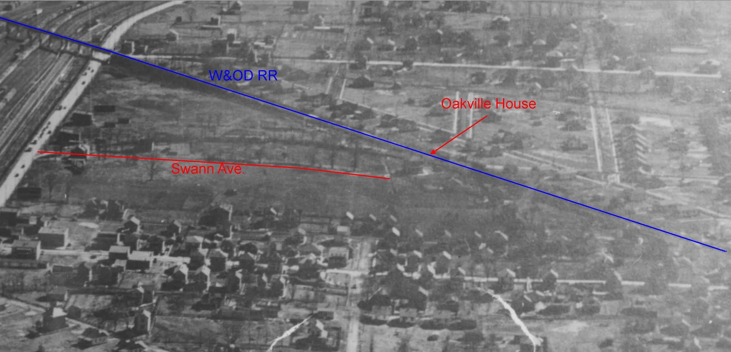
Oakville estate circa 1919 with the tree lined driveway that is now Swann Avenue to the plantation house.

Originally published in the August 2023 edition of Greet Del Ray.

Now that Oakville Triangle is being redeveloped again, it is time to remember its legacy.

William Swann married Frances B. Alexander, the granddaughter of the founder of Alexandria, and inherited “Preston”, the Alexander plantation just north of the original city (located on the new Virginia Tech campus). When their youngest son, Thomas William Swann, married Helen M. Chapman in 1830, they received over 100 acres of land to live and work on. Swann built a home on it and dubbed it “Oakville.” Swann grew primarily hay, rye, oats and corn and had 6 adult slaves in 1860.

In the late 1850s, the predecessor to the Washington & Old Dominion Railroad purchased a right of way through Swann's farm, building their line to Alexandria only about 125 feet from his home. The advent of the railroad prompted Swann to move his family up to the ridgeline which became a popular location for wealthy estates. Thomas built a new home called “Mt. Auburn” situated on the highest point of what is now The Aspen Apartments' parking lot. He retained and continued to farm Oakville for the remainder of his life, and the original plantation house remained. Thomas and Helen both died in 1895, leaving their estate to their only living child, Susan Pearson Alexander Calvert.

Susan's husband, George E. Calvert, was a government clerk, and they were not prepared to continue operating the vast farmland. They began selling off the land. The farm that had been 118 acres in 1860, was less than 60 acres by 1900 and was divided by the new development of St. Elmo. Their land was also divided by the new Mt. Vernon Ave. and the electric trolley line to Washington (now Commonwealth Ave.). After Susan died in 1919, the original Oakville plantation house, which she was born in, was torn down. Her daughter, Helen Calvert inherited the land, and she slowly sold off her estates. The 21.5 acres she owned further south was donated to create the George Washington High School (now a Middle School). The 10 acres of land between Glebe Rd. and Ashby St. became Auburn Gardens Apartments (now Auburn Village Condos). The 15 acres around the original Oakville house was sold off and developed in the early 1960s into Oakville Triangle industrial park.

Origins of the Mount Ida Neighborhood

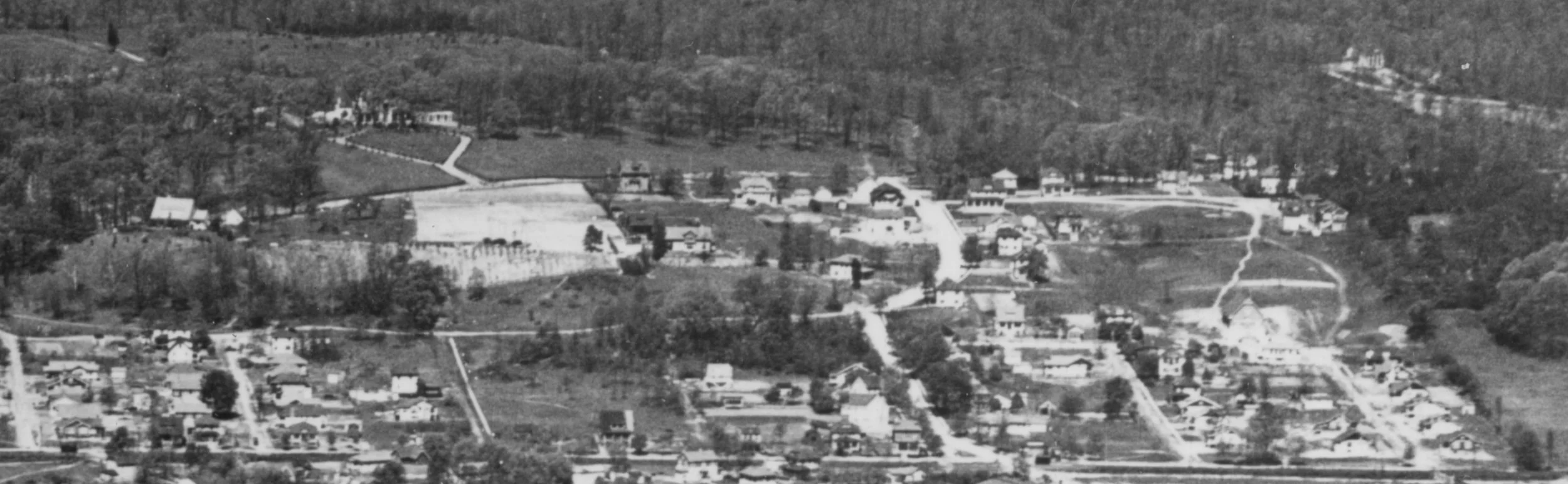
Mount Ida circa 1923.

Originally published in the June 2023 edition of Greet Del Ray.

At the beginning of the 20th Century, the ridge to the west of Russell Road was dotted with homes of wealthy businessmen and land owners. These homes include the Swann/Calvert family home “Mount Auburn” (for which Auburn Village is named), the Hume family home of “Warwick” (for which Warwick Village is named) and the John Lloyd family home “Mount Ida” (for which the Mount Ida development is named). Of these three houses, only “Mount Ida” remains standing at 305 Charles Alexander Court. More information about “Mount Ida” can be found in Daniel Koski-Karrell's 1993 study of the house, which is available on the City's website.

In the early part of the 20th Century, the heirs of John Lloyd began selling off parcels. In 1908, Mr. James S. Groves began acquiring 150 acres of the Lloyd estate and formed the Mount Ida Realty Company. Groves was the President of the Company, and James R. Caton was the Secretary. The company laid out the Mount Ida development bounded by Russell Road, Del Ray Avenue, Commonwealth Avenue and Forrest Avenue/Holly Street/McArthur Road. The initial 14 blocks of Mount Ida were laid out in early 1909 as the Groves Subdivision. In July 1909, the Mount Ida Realty Company completed the purchase of Lot 3 of the estate from George and Nellie Uhler and began laying out an additional subdivision consisting of blocks 15-17 of Mount Ida (between Uhler and Wyatt Aves.). Many of the original streets were named after the Lloyd family (Lloyd Avenue, Woolfolk Avenue, Alexander Avenue, and Uhler Avenue), but several of these street names were changed after the area was annexed into the City of Alexandria.

Once the plats were approved and filed, the company began selling the lots. During this era, developers sold lots, and the purchasers constructed the home. The original subdivision was sold off and developed first, and development of Blocks 15-17 did not start until the 1920s.

The Beginning of Del Ray.

Originally published in the April 2023 edition of Greet Del Ray.

When Charles E. Wood of the real estate development company Wood, Harmon and Company began his first development in Northern Virginia, he needed a location reasonably close to transportation, yet still rural in character. The farms north of Alexandria afforded an excellent opportunity because the transportation lines between Washington and Alexandria crisscrossed this land. In 1894, he purchased two large tracts of land north of Alexandria just off the road and rail lines to Washington.

The first tract of land consisted of 254 acres just south of the St. Asaph Racetrack that had been part of the Lloyd family’s Belmont estate. Wood named this area Del Ray and hired D. J. Howell to survey it into 1160 lots. Standard lots measured 25 feet wide and 115 feet deep. The other tract consisted of 38.68 acres from Frank and Emma Hume that lay between the St. Asaph racetrack and Glebe Road. It was named St. Elmo, and L. H. Hyer surveyed it into 491 lots. Here, standard lots were 25 feet wide and 120 feet deep. Streets were laid out in a grid pattern within the irregular boundaries of the tracts. Wood paid a total of $54,216 for the two tracts of land, and he expected to triple his original investment by selling the lots for between $50 and $150.

St. Elmo was completed first, and Wood began selling lots on 2 April 1894. Jefferson and Emma Ashford purchased two lots to construct the first home in St. Elmo at 301 Clifford Ave. This house was described as a Folk Victorian and was designated a contributory structure to the Town of Potomac National Historical District (Potomac NHD). Unfortunately, it was torn down in 2015.

When Wood began selling lots in Del Ray one month later, it immediately proved more successful. George and Martha Mundell constructed the first house at 208 E. Howell Ave. It is also a contributory structure to the Potomac NHD, which listed it as a c. 1895 Vernacular house. The Mundells purchased a second lot and expanded the original house.